|
||
|
Use your data collector to locate traverse data and TOPO locations out in the field, then use the data collection features to bring the field data right into the drawing.
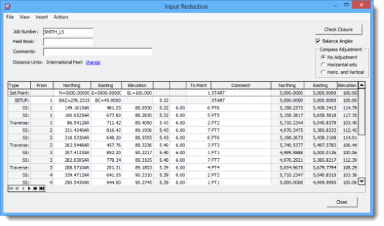
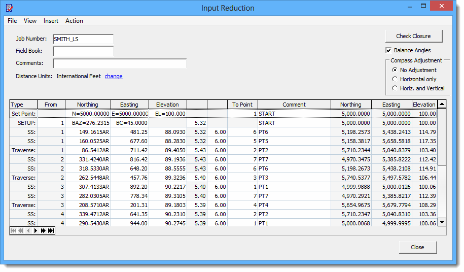
The Input Reduction editor provides you with an easy to use spreadsheet to edit your field files and raw data. Invalid entries are highlighted in red so that mistakes are easier to fine. Coordinates and elevations are automatically calculated and displayed as you work.
Custom Feature Codes Use blocks (symbols) to create your own custom feature codes. Just enter the name of the block as a feature code along with its attributes and the block will be inserted when the field file is processed.
* Supports TDS RAW and RW5 data collector files
|
||
|